Projets
Exemples concrets de travaux géomatiques réalisés.
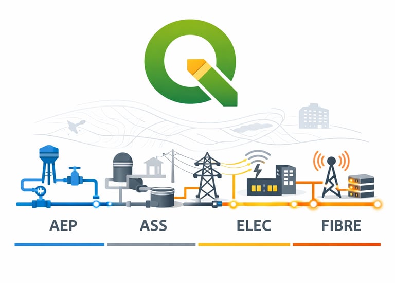
SIG des réseaux
Création d'un SIG de réseaux urbains


Gestion d'une base de donnée
Administration d'une base spatiale PostGres

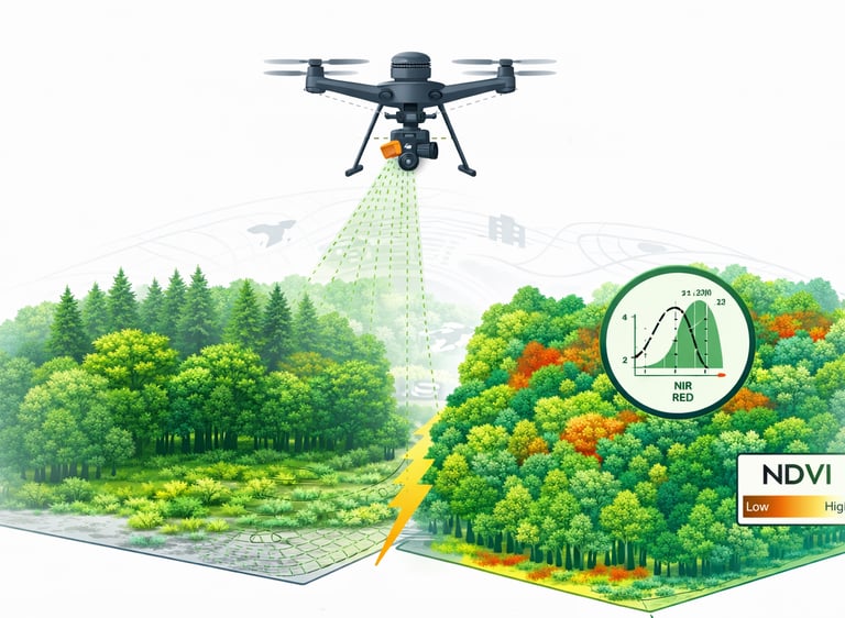


Télédétection haute résolution
Recherche experimentale d'espèces invasives
Solution Python - Plan de route
Solution de gestion de flotte de véhicules
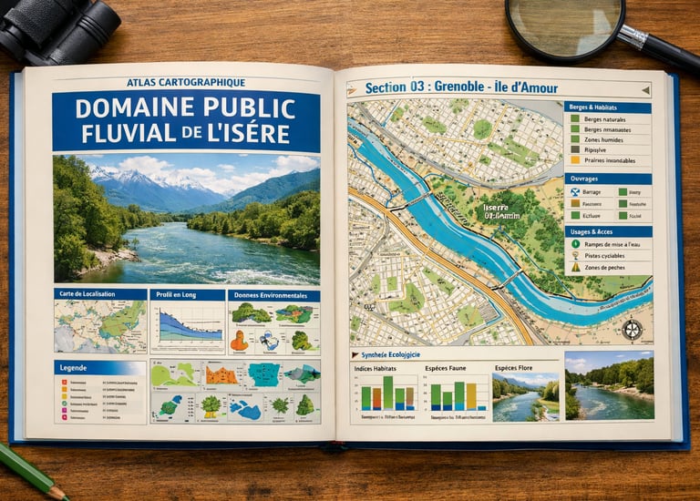
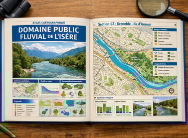
Atlas de l'Isère
Cartographie du domaine public fluvial
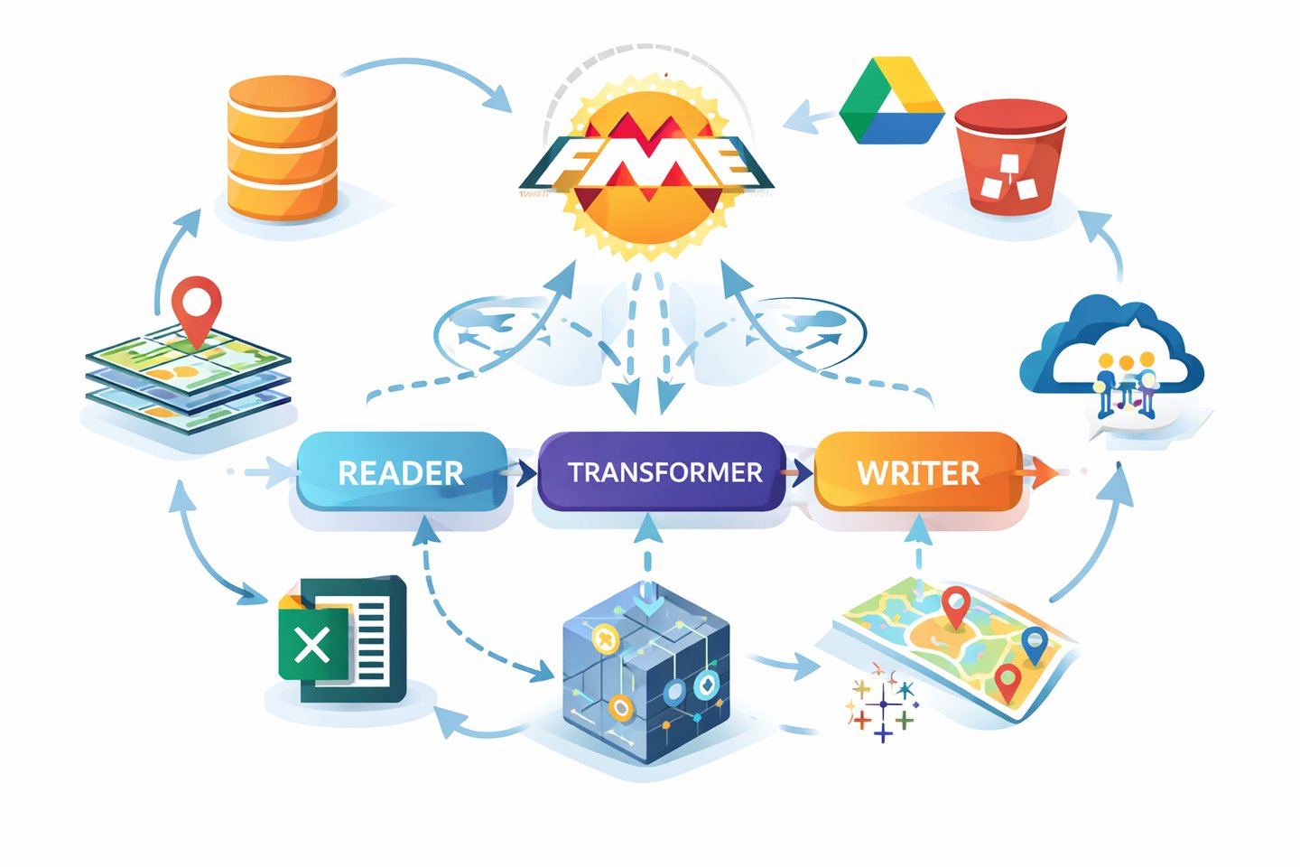
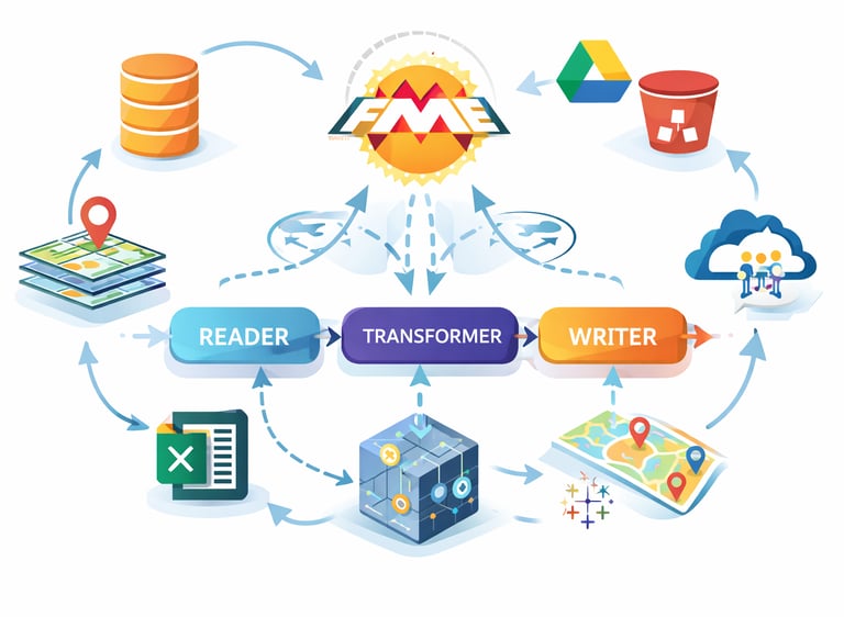
Développement FME
Développement d'un outils de contrôle des données
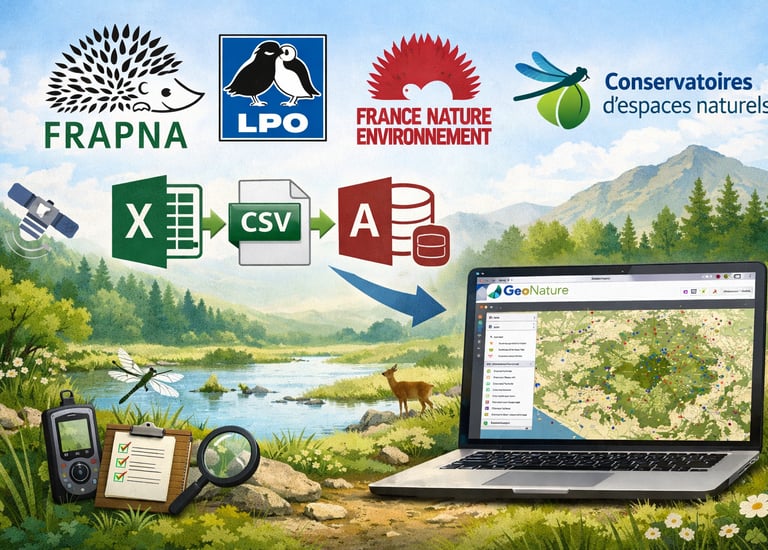
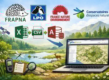
Gestion de données naturalistes
Centralisation de données naturalistes